High-Precision Drone Surveys for Agriculture, Infrastructure, and Urban Development
At Falcon Info Solutions, we specialize in next-gen aerial survey solutions powered by advanced drone technology and AI-driven analytics. From mapping rural landscapes to inspecting critical infrastructure, our drone fleet delivers accurate, scalable, and cost-effective insights that empower smarter decisions
Our advanced fleet includes IdeaForge Q6 UAV, Trinity F90 Plus, and Skydio X2, purpose-built for ultra-precise
aerial mapping, terrain modeling, and high-risk inspection missions across diverse sectors.
Our Drone Survey Projects
See the Sky-High Impact Across India
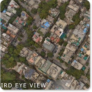
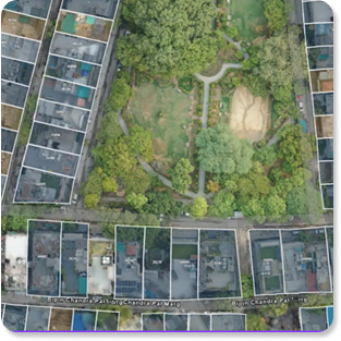
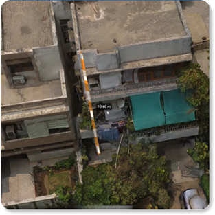
From dense urban layouts to wide agricultural zones, our drone imagery captures intricate details with unmatched clarity. Here’s a glimpse of the aerial perspectives delivered by our high-precision mapping and modeling solutions.
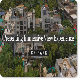
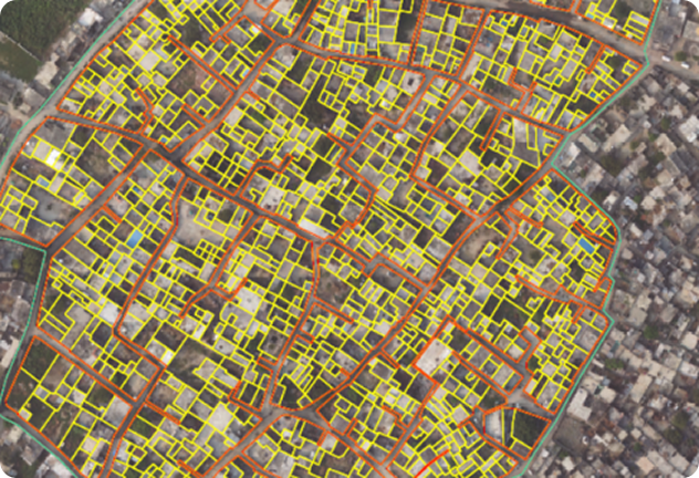
Falcon Info Solutions successfully developed a 3D City and Digital Twin Model of CR Park, mapping over 1,800
households. This pioneering project, in collaboration with the Ministry of Home & Urban Affairs, marked a first
of-its-kind milestone in India's urban planning initiatives.
Land Mapping at Scale
Swamitva Project – Himachal
Pradesh
Falcon completed a large-scale aerial survey covering approximately 400 sq. km in Himachal Pradesh as part of the Swamitva initiative. Our operations included high-resolution drone mapping, image processing of AOI (Area of Interest), and seamless digital data delivery.
Scope Highlights
High-accuracy drone mapping
Orthomosaic imagery processing
Delivery of georeferenced data sets
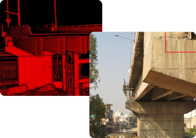
AI-Enabled Structural Health Monitoring
Bridge Inspection – MoRTH
(Ministry of Road Transport &
Highways)
Falcon successfully conducted a complete drone-based inspection of a rail-over bridge in Palwal, Haryana, using high resolution imaging and AI-driven analysis. This was part of a proof-of-concept project for the Ministry of Road Transport & Highways, in collaboration with IIT Chennai (mentor) and Trimble (implementing partner).
Scope Highlights :
Drone-enabled visual inspection.
AI assessment of bridge condition and lifespan.
Scalable solution for future national infrastructure projects.
Ready to Elevate Your Project?
Whether you’re planning a government initiative, agricultural mapping, or infrastructure inspection, Falcon’s AI-powered aerial solutions provide the data you need to make smarter, faster decisions. Let’s collaborate on transforming India’s landscape—one flight at a time.